Research Spotlight: Cape Romain Partnership for Coastal Protection
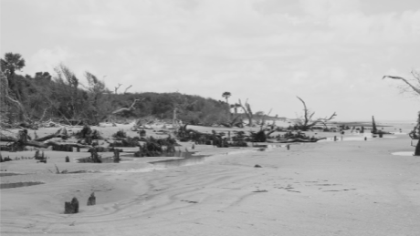

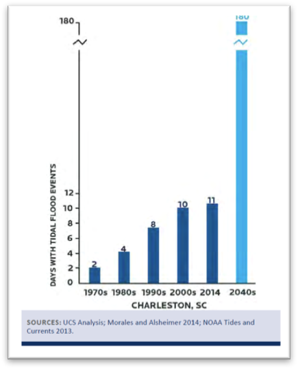
Coastal regions of the southeastern US are experiencing dramatic changes affecting critical habitat for wildlife as well as threatening the safety and livelihoods of millions of residents living near the coast. Increased flooding results in habitat loss and pollution runoff that closes economically important fishing grounds and impacts water quality; rising seas are eroding beaches, marshes, and barrier islands, increasing the exposure of infrastructure and inland habitat to more severe storms; and urban growth is displacing traditional communities and reducing access to natural areas and quality of life for the region.
Although protected areas such as National Wildlife Refuges are recognized for providing habitat for resident and migrating wildlife and recreational opportunities for visitors and residents, there is little appreciation for the full range of benefits provided by a healthy coastal ecosystem, such as improved water quality and filtration services, storm protection, spawning grounds for robust fisheries, and cultural and community wellbeing. Likewise, traditional management of public lands rarely considers the full extent of societal objectives when making decisions about natural resources and the goods and services they produce.
Addressing the challenges of changes in the southeastern US will be most effectively achieved at the local level, by including in the decision-making process those communities and individuals most affected. This requires input from decision makers, scientists, and other stakeholders to build collective understanding of this context and identify solutions that benefit multiple interests. The SE Climate Science Center has partnered with the South Carolina Low-Country Wildlife Refuge Complex to engage with local communities, agencies, and organizations to understand shared values and interests, strategies to adapt to current and future changes, and areas of collaboration or possible conflict as stakeholders act to influence their futures.
Project goals are to: 1) produce science that is useful for those working to protect coastal resources in South Carolina, using state-of-the-art technologies; 2) collectively, describe plausible futures that can serve as a basis for communication among diverse stakeholders; and 3) foster greater understanding and more collaborative decision making among those that benefit from and value Cape Romain and the surrounding area.
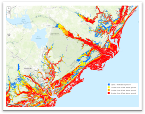
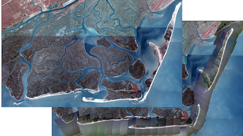
This project involves an integration of scientific assessments with stakeholder-engagement activities. The partnership is producing a wide array of forecast data, including coastal impacts from rising seas and increased storm severity, trends in biophysical conditions and resources, human demography and the vulnerability of underrepresented communities, and rates of urban development affecting the production of desired goods and services and the opportunities for other land uses. We are developing novel approaches to elicit and incorporate relevant values and data into a transparent decision-making process. Scenario planning methods are being used to capture stakeholder interests, identify external drivers perceived to affect desired futures, and design collective strategies that may be robust to inherent uncertainties. These findings are being incorporated into decision models developed to guide land-use planning policies to best achieve stated objectives for natural resources and livelihoods, while considering risk and possible conflicts among stakeholders.
Project Leaders: Mitchell Eaton (DOI, SE Climate Science Center), Fred Johnson and Julien Martin (USGS, Wetland and Aquatic Research Center), Jessica Mikels-Carrasco and David Case (DJ Case and Associates).
Stakeholders: US Forest Service, SC Dep. of Natural Resources, The Nature Conservancy, SC Sea Grant, Center for Heirs Property, SC Aquarium, local land trusts, University of SC, SC Environmental Law Project, local communities.
Research Partners: USFWS-Cape Romain National Wildlife Refuge, Department of Agricultural Economics (NCSU), Department of Forestry and Environmental Resources (NCSU), NOAA.
Get more information on the SE CSC project page and see where the project is being implemented on our Story Map.
- Categories: